18.20.110 N (Neighborhood)
Purpose: The N (Neighborhood) District provides for mixed-use centers where designated in the Comprehensive Plan, or as part of a master planned development. This district implements the mixed-use and mixed-income neighborhood policies of PlanOlathe (LUCC 3.1, -4.1, -8.1; HN 1.2). The N district is required for rezoning applications that fall within both a center (such as Community Commercial and Neighborhood Commercial) and mixed-use residential neighborhood land use categories of PlanOlathe. The N district is also suitable for planned mixed-use development that diversifies and integrates land uses within close proximity to each other and offers a greater variety in type, design, and layout of residential and nonresidential uses.
The N District implements the Neighborhood Commercial Center, Community Commercial Center, and Mixed-Use Residential Neighborhood future land use categories and the following Comprehensive Plan policies:
•LUCC 3.1: Encourage housing near services, including a Mixed-Use Neighborhood zoning district.
•HN-2.2: Complete Neighborhoods. Encourage a “complete” neighborhood concept for new development.
•HN-2.3: Higher Residential Densities. Target future medium- and high-density residential development to locations that are accessible to and integrated with potential employment and transit centers.
•LUCC-3.3: Ensure that zoning allows for a variety of home types and lot sizes.
•LUCC-4.1: Support viable mixed-use and mixed-density neighborhoods.
•Principle LUCC-5: Develop commercial centers of an appropriate size and scale, and within the right locations, to ensure economic sustainability and shape community form.
•LUCC-5.1: Hierarchy of Activity Centers. Focus new commercial centers in concentrated activity areas at a variety of scales distributed throughout the community.
•LUCC-7.4: Alternative Zoning Techniques in Mixed-Use Neighborhoods.
•LUCC-8.1: Mixture of Complementary Land Uses.
•HN-1.2: Mixed Uses and Mixed Incomes.
•HN-2.1, HN-2.5, HN-4.1, and HN-4.2: Provide a full range of housing choices, affordable housing, and neighborhoods that enable residents to “age in place.”
A. Land Use Allocations
An N district must include two types of areas: Mixed Residential (MRA) and Center (CA). The district may also include supportive uses, civic uses, and civic spaces within the total development. Each type of area has different land use and site development regulations. These areas are designated on the preliminary development plan for a rezoning or a site development plan within an existing N district. The description, basic requirements, and the minimum amount of land area, floor area and dwelling units required for each area are provided below:
|
Area |
Description |
Allocation/Basic Requirements |
|---|---|---|
|
Mixed Residential Area (MRA) |
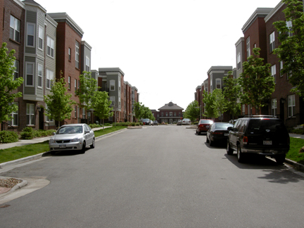
An MRA includes a variety of residential land uses mixed throughout the neighborhood or within a block. In addition, offices, retail stores, and cafes are permitted in residential areas under strict scale, architectural building design, and land use controls. The MRA may include open spaces consisting of small squares, pocket parks, community parks, and greenbelts. All areas of an MRA are designed in a manner to promote pedestrian activity through a system of interconnected streets and varied streetscapes that also provide safe and efficient movement of vehicular traffic. Residential densities are higher than conventional single-family subdivisions. |
• Minimum allocation: all areas within an N District designated as a “Mixed-Use Residential” future land use category in the Comprehensive Plan. |
|
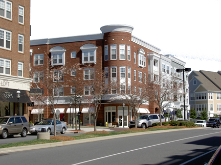
Center Area (CA) |
A CA serves as the neighborhood focal point. It contains commercial, civic, and public services to meet the daily needs of neighborhood residents. A wide mix of neighborhood-oriented uses are encouraged for a CA, such as small scale retail shops, restaurants, offices, banks, hotels, post offices, governmental offices, churches, community centers, and attached residential dwellings. Vertically mixed-use buildings are permitted in order to create a greater mix of people and activities. A CA is pedestrian-oriented, with on- and off-street parking and loading areas behind buildings. The CA is designed to encourage pedestrian movement and interaction with the adjacent MRA. |
• The CA must contain at least twenty-five (25) percent of the gross land area, including all areas designated as a “Community Commercial Center” or “Neighborhood Center” future land use category in the Comprehensive Plan. |
|
Supportive Uses |
The district may include commercial, light industrial, large office and low-impact manufacturing uses on a limited basis. These uses are subject to siting, scale and building design controls to ensure that they do not disrupt the district’s character. This gives applicants the flexibility to incorporate these uses as anchors or supportive uses, while maintaining the appearance and function of a compact neighborhood. |
• Supportive uses are limited to “B” streets designated on the preliminary development plan or site development plan. • “B” streets are limited to ten (10) percent of the linear street frontage of the application. • The land area occupied by supportive uses is limited to fifteen (15) percent of the total land area of the N district. |
|
Civic uses can complement the social and physical fabric of a neighborhood. These include government offices, libraries, museums, schools, churches, and other prominent public buildings. These uses are sited and regulated to create focal points and landmarks for the community. The locations of these major public civic uses are designated on the preliminary development plan or site development plan. |
• No minimum allocation applies. • Civic uses are limited to twenty-five (25) percent of the land area within the N district. |
|
|
Formal and informal civic spaces can provide areas for community gatherings, landmarks, and as organizing elements for the neighborhood. Examples include squares, plazas, greens, preserves, parks, and greenbelts. The regulations provide for functional yet compact spaces that are appropriately sized for the relatively urban context of these areas, and allow for their joint use for buffering, transitions to surrounding neighborhood, and stormwater management. |
• Minimum allocation: five (5) percent of the land area within the MRA, and two (2) percent of the land area within the CA. • Maximum allocation: twenty (20) percent of the land area within the MRA, and fifteen (15) percent of the land area within the CA. |
B. Permitted Uses
|
Area |
See Section 18.20.500 (Use Matrix) |
Allocations |
|---|---|---|
|
Mixed Residential Area (MRA) |
• Any use permitted in the R-2, R-3, R-4, and C-1 districts |
• Single-family residences are limited to eighty (80) percent of the gross land area within the MRA. |
|
Center Area (CA) |
• Any use permitted in the C-1 or C-2 district • Any multifamily residence permitted in the R-4 district |
• Multifamily or townhouse uses must occupy at least twenty (20) percent of the floor area in the CA. |
|
Supportive Uses |
• Any use permitted in the C-4 district, subject to the design standards in this section |
• See subsection A, above. |
|
• Any civic assembly (such as a church or meeting hall – see Use Matrix) |
• See subsection A, above. |
|
|
• See Section 18.30.170 (Parks/Open Space/Civic Space Standards) |
• See subsection A, above. |
C. Dimensional Standards
Development in the N District is subject to the following dimensional standards:
|
MRA |
CA |
Supportive Uses |
||
|---|---|---|---|---|
|
Density (minimum) |
• 7 units/acre |
• n/a |
• n/a |
• n/a |
|
Density (maximum) |
• 35 units/acre |
• 45 units/acre |
• n/a |
• n/a |
|
Lot width (minimum) |
• 40 feet (single-family only) |
• 10 feet |
• 10 feet |
• 10 feet |
|
Height (maximum) |
• 35 feet (single-family, duplex) • 75 feet (multifamily, nonresidential) |
• 7 stories/90 feet |
• 35 feet |
• 72 feet |
|
Front yard (minimum) |
• 10 feet (single-family only) |
• n/a |
• n/a |
• n/a |
|
Front yard (maximum – applies to area within frontage buildout) |
• 15 feet |
• 5 feet |
• n/a |
• n/a |
|
Frontage buildout (minimum) |
• 50% |
• 80% |
• n/a |
• n/a |
|
Side yard (minimum) |
• 5 feet (single-family, required on 1 side only) |
• n/a |
• n/a |
• n/a |
|
Corner side yard (minimum) |
20 feet |
• 20 feet |
• 20 feet |
• 20 feet |
|
Rear yard (minimum) |
• 5 feet |
• n/a |
• 5 feet |
• 5 feet |
|
Common open space/civic space (minimum %/minimum % of total that is active open space) |
• 5%/50% |
• 2%/50% |
• n/a |
• n/a |
D. Additional Regulations for Mixed Residential Area:
1. See Chapters 18.30 (Development Standards) and 18.50 (Supplemental Use Regulations).
2. Projects must incorporate Site Design Category 3.
3. A commercial use may only be located:
a. On the first floor of a building, with up to one-half (½) of the second floor allowed for accessory uses that are not open to the public, or
b. On a corner lot, with a maximum lot size of twenty thousand (20,000) square feet.
4. Commercial uses are limited to corner locations that are designated on the development plan.
5. Setback requirements listed in the dimensional standards table are minimum requirements and may be required to be greater to accommodate landscape buffer requirements found in Section 18.30.130.
E. Additional Regulations for Center Area
1. See Chapters 18.30 (Development Standards) and 18.50 (Supplemental Use Regulations).
2. Setback requirements listed in the dimensional standards table are minimum requirements and may be required to be greater to accommodate landscape buffer requirements found in Section 18.30.130.
3. Setback and Sidewalk Encroachments
a. An open colonnade may extend into the front setback a maximum of five (5) feet.
b. An unenclosed balcony with a minimum clearance of nine (9) feet above finished grade may extend five (5) feet over a public sidewalk.
c. An awning or walkway covering with a minimum clearance of eight (8) feet above finished grade may extend five (5) feet over a public sidewalk.
4. Off-Street Parking.
a. An off-street parking lot must be located behind or along the side(s) of buildings, except for supportive uses.
b. Parking lots must be set back at least fifteen (15) feet from the front property line. (Ord. 19-64 § 6, 2019; Ord. 15-16 §3, 2015)